
Aragua topographic map
Interactive map
Click on the map to display elevation.
About this map
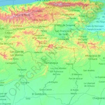
Name: Aragua topographic map, elevation, terrain.
Location: Aragua, Central, Venezuela (9.24875 -67.88185 10.60149 -66.54752)
Average elevation: 487 m
Minimum elevation: 0 m
Maximum elevation: 2,666 m
Other topographic maps
Click on a map to view its topography, its elevation and its terrain.