
Owerri West topographic map
Interactive map
Click on the map to display elevation.
About this map
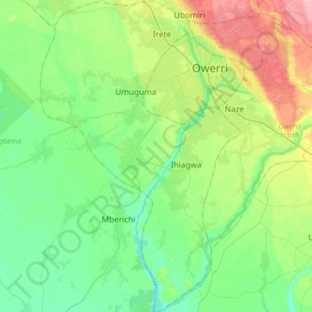
Name: Owerri West topographic map, elevation, terrain.
Location: Owerri West, Imo, Nigeria (5.26548 6.87813 5.55111 7.06220)
Average elevation: 62 m
Minimum elevation: 27 m
Maximum elevation: 146 m
Other topographic maps
Click on a map to view its topography, its elevation and its terrain.