
Annapurna topographic map
Interactive map
Click on the map to display elevation.
About this map
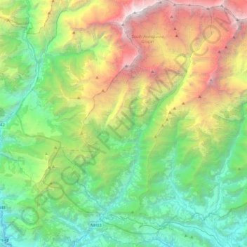
Name: Annapurna topographic map, elevation, terrain.
Location: Annapurna, Kaski, Gandaki Pradesh, Nepal (28.25514 83.69944 28.61295 83.94755)
Average elevation: 2,974 m
Minimum elevation: 747 m
Maximum elevation: 8,013 m
Other topographic maps
Click on a map to view its topography, its elevation and its terrain.
Mera Peak
Nepal > Solukhumbu > Bung
In September 2017, Hari Budha Magar summited Mera Peak, in doing so he became the first ever double above-knee amputee to climb a mountain over 6,000m in altitude.[9]
Average elevation: 5,709 m