
Mai-Ndombe topographic map
Interactive map
Click on the map to display elevation.
About this map
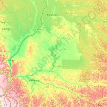
Name: Mai-Ndombe topographic map, elevation, terrain.
Location: Mai-Ndombe, Democratic Republic of the Congo (-4.52570 15.69978 0.67430 20.89978)
Average elevation: 358 m
Minimum elevation: 271 m
Maximum elevation: 709 m
Other topographic maps
Click on a map to view its topography, its elevation and its terrain.