
Sagar topographic map
Interactive map
Click on the map to display elevation.
About this map
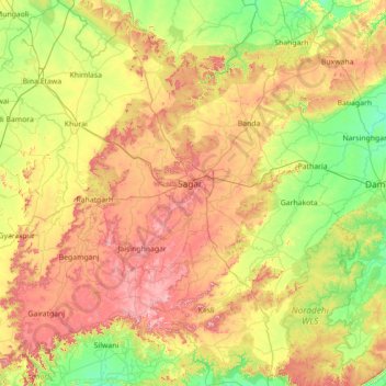
Name: Sagar topographic map, elevation, terrain.
Location: Sagar, Madhya Pradesh, India (23.16541 78.05973 24.45121 79.35233)
Average elevation: 451 m
Minimum elevation: 322 m
Maximum elevation: 678 m
Other topographic maps
Click on a map to view its topography, its elevation and its terrain.