
Kwango topographic map
Interactive map
Click on the map to display elevation.
About this map
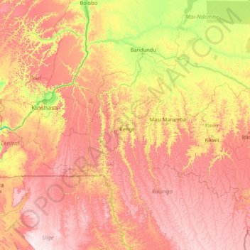
Name: Kwango topographic map, elevation, terrain.
Location: Kwango, Democratic Republic of the Congo (-7.40699 14.39661 -2.20699 19.59661)
Average elevation: 587 m
Minimum elevation: 187 m
Maximum elevation: 1,282 m
Other topographic maps
Click on a map to view its topography, its elevation and its terrain.