
Mandla topographic map
Interactive map
Click on the map to display elevation.
About this map
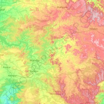
Name: Mandla topographic map, elevation, terrain.
Location: Mandla, Madhya Pradesh, India (22.20131 79.95235 23.17214 81.19549)
Average elevation: 598 m
Minimum elevation: 324 m
Maximum elevation: 1,042 m
Other topographic maps
Click on a map to view its topography, its elevation and its terrain.