
Olorunda topographic map
Interactive map
Click on the map to display elevation.
About this map
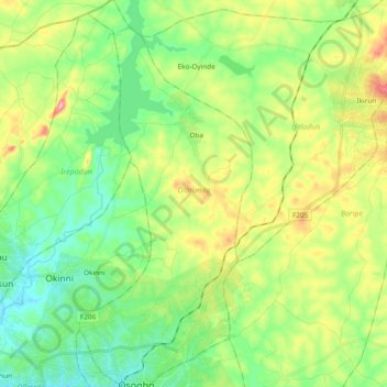
Name: Olorunda topographic map, elevation, terrain.
Location: Olorunda, Osun State, Nigeria (7.77757 4.52603 7.96507 4.61066)
Average elevation: 353 m
Minimum elevation: 290 m
Maximum elevation: 477 m
Other topographic maps
Click on a map to view its topography, its elevation and its terrain.