
Sulu topographic map
Interactive map
Click on the map to display elevation.
About this map
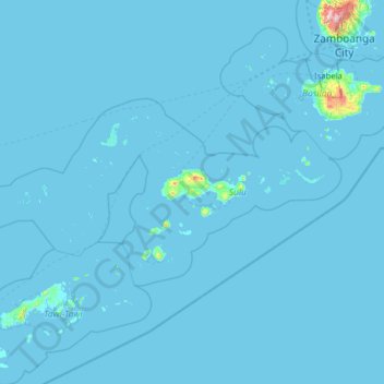
Name: Sulu topographic map, elevation, terrain.
Location: Sulu, Bangsamoro, Philippines (5.32889 119.53001 6.55497 122.05671)
Average elevation: 9 m
Minimum elevation: -1 m
Maximum elevation: 1,290 m
Other topographic maps
Click on a map to view its topography, its elevation and its terrain.