
Honduras topographic map
Interactive map
Click on the map to display elevation.
About this map
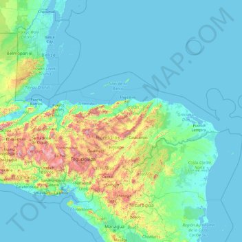
Name: Honduras topographic map, elevation, terrain.
Location: Honduras (12.98085 -89.35682 17.61953 -82.17296)
Average elevation: 199 m
Minimum elevation: -2 m
Maximum elevation: 2,751 m
Other topographic maps
Click on a map to view its topography, its elevation and its terrain.
Coxen Hole
Honduras > Bay Islands > Coxen Hole
Coxen Hole, Roatan, Bay Islands, Honduras
Average elevation: 3 m
Río Plátano Biosphere Reserve
Río Plátano Biosphere Reserve, Brus Laguna, Gracias a Dios, Honduras
Average elevation: 179 m