
Holosiivskyi District topographic map
Interactive map
Click on the map to display elevation.
About this map
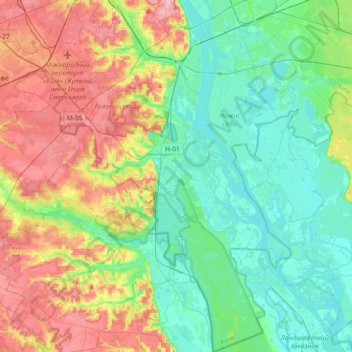
Name: Holosiivskyi District topographic map, elevation, terrain.
Location: Holosiivskyi District, Kyiv, Ukraine (50.21324 30.43027 50.44195 30.64732)
Average elevation: 128 m
Minimum elevation: 86 m
Maximum elevation: 208 m
Other topographic maps
Click on a map to view its topography, its elevation and its terrain.