North Carolina topographic maps
Click on a map to view its topography, its elevation and its terrain.

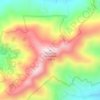

William B. Umstead State Park
United States > North Carolina > Wake County > Raleigh
Umstead is part of the Southeastern mixed forests ecoregion. The topography is hilly, and it has several artificial lakes (which are very common in Wake County, partially due to a flood control plan implemented over the last half-century).
Average elevation: 116 m

Carolina Beach
United States > North Carolina > New Hanover County
Carolina Beach is characterized by its relatively flat topography, with elevations averaging around 13 feet above sea level. This coastal town is part of Pleasure Island and features a blend of sandy beaches and salt marshes. The surrounding area includes Carolina Beach State Park, which hosts diverse…
Average elevation: 2 m

West Jefferson
United States > North Carolina > Ashe County
West Jefferson is a popular destination among tourists and retirees from Florida, as well as those from the lower elevations of the Carolinas and Georgia.
Average elevation: 1,002 m


Blue Ridge Parkway
United States > North Carolina > Watauga County
The parkway has been the most visited unit of the National Park System every year since 1946 except four (1949, 2013, 2016 and 2019).[4][5] Land on either side of the road is owned and maintained by the National Park Service, and in many places parkway land is bordered by United States Forest Service property.…
Average elevation: 504 m


Doughton Park
United States > North Carolina > Wilkes County
Doughton Park (Doughton Recreational Area) is the largest recreation area the National Park Service manages on the Blue Ridge Parkway. It is located between mile markers 238.5 - 244.7 on the border between Wilkes and Alleghany Counties in North Carolina. Doughton Park consists of highland meadows with numerous…
Average elevation: 855 m

Arden
United States > North Carolina > Buncombe County > Asheville > Royal Pines
Average elevation: 693 m


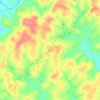


Cramerton
United States > North Carolina > Gaston County
Cramerton is located at an elevation of 620 feet (189 m). Two topographic high points, Berry Mountain, elevation 922 feet (281 m), and Cramer Mountain, approximate elevation 850 feet (259 m), are located in the southwestern part of town.
Average elevation: 202 m

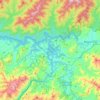
Fontana Lake
United States > North Carolina > Swain County
Fontana Lake provides the only access into the most remote areas of the National Park, unless visitors undertake a multi-day hike to get there. When the lake is at the normal summer level, a boat may be used to access remote trailheads such as Hazel Creek. From the observation tower on Kuwohi, on a clear day…
Average elevation: 806 m
South Mountains State Park
United States > North Carolina > Burke County
While most of the high points average approximately 2000 feet (609 m) in elevation, Buzzard's Roost towers some 3000 feet (914 m) above the surrounding landscape. Elevations within the park itself range from less than 1200 feet (365 m) at points along Jacob's Fork River to 3,000 feet (914 m) on Buzzard's Roost…
Average elevation: 498 m
Gorges State Park
United States > North Carolina > Transylvania County
Following the flood, local citizens eventually sold large land tracts in the Gorges to Singer Sewing Machine Company, which logged most of the land. Then, in the 1940s and 1950s, Singer sold the land to Duke Energy Corporation. The corporation purchased the land for its steep topography and high rainfall,…
Average elevation: 682 m












Hiddenite
United States > North Carolina > Alexander County
Hiddenite's altitude is 1,160 feet (350 m) above sea level. The community is also a poultry producer.
Average elevation: 333 m
Terrell
United States > North Carolina > Catawba County
Terrell is located at 35°35′20.72″N 80°58′39.5″W / 35.5890889°N 80.977639°W / 35.5890889; -80.977639 within area code 828, ZIP code 28682, and FIPS place code 67180. It sits at an elevation of 289 m (948 ft).
Average elevation: 247 m


Beech Mountain
United States > North Carolina > Watauga County > Beech Mountain
Average elevation: 1,264 m


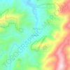

Morning Star Acres
United States > North Carolina > Mecklenburg County > Charlotte
Average elevation: 206 m

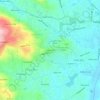


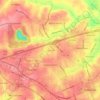
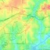

Glenn Brook
United States > North Carolina > Henderson County > Hendersonville
Average elevation: 678 m







Jefferson Village
United States > North Carolina > Davidson County > Lexington
Average elevation: 225 m