
Thank you for supporting this site ❤️
Make a donation
Make a donation
Boluwaduro topographic map
Click on the map to display elevation.
Thank you for supporting this site ❤️
Make a donation
Make a donation
About this map
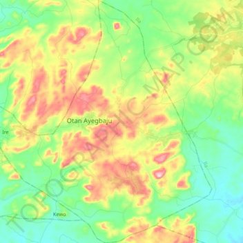
Name: Boluwaduro topographic map, elevation, terrain.
Location: Boluwaduro, Osun State, Nigeria (7.86373 4.72121 8.02867 4.87122)
Average elevation: 477 m
Minimum elevation: 367 m
Maximum elevation: 663 m
Thank you for supporting this site ❤️
Make a donation
Make a donation
Other topographic maps
Click on a map to view its topography, its elevation and its terrain.