
Bebeji topographic map
Interactive map
Click on the map to display elevation.
About this map
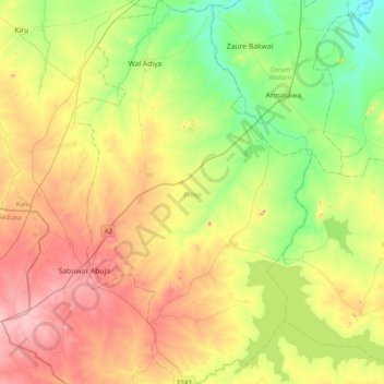
Name: Bebeji topographic map, elevation, terrain.
Location: Bebeji, Kano, Nigeria (11.34455 8.18854 11.73188 8.43414)
Average elevation: 531 m
Minimum elevation: 440 m
Maximum elevation: 655 m
Other topographic maps
Click on a map to view its topography, its elevation and its terrain.