
Igman topographic map
Interactive map
Click on the map to display elevation.
About this map
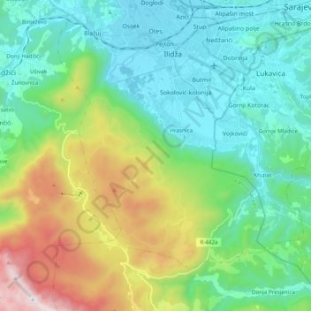
Name: Igman topographic map, elevation, terrain.
Location: Igman, Ilidza municipality, Sarajevo Canton, B&H (43.72396 18.20091 43.84744 18.40954)
Average elevation: 909 m
Minimum elevation: 483 m
Maximum elevation: 2,040 m
Other topographic maps
Click on a map to view its topography, its elevation and its terrain.