
Sarajevo Canton topographic map
Interactive map
Click on the map to display elevation.
About this map
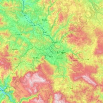
Name: Sarajevo Canton topographic map, elevation, terrain.
Location: Sarajevo Canton, B&H (43.58693 18.00096 44.12066 18.62962)
Average elevation: 957 m
Minimum elevation: 274 m
Maximum elevation: 2,065 m
Other topographic maps
Click on a map to view its topography, its elevation and its terrain.