
Thank you for supporting this site ❤️
Make a donation
Make a donation
Billiri topographic map
Click on the map to display elevation.
Thank you for supporting this site ❤️
Make a donation
Make a donation
About this map
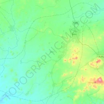
Name: Billiri topographic map, elevation, terrain.
Location: Billiri, Gombe State, Nigeria (9.67464 10.94894 9.99420 11.29114)
Average elevation: 421 m
Minimum elevation: 271 m
Maximum elevation: 1,122 m
Thank you for supporting this site ❤️
Make a donation
Make a donation
Other topographic maps
Click on a map to view its topography, its elevation and its terrain.