
Thank you for supporting this site ❤️
Make a donation
Make a donation
Perry Park topographic map
Click on the map to display elevation.
Thank you for supporting this site ❤️
Make a donation
Make a donation
About this map
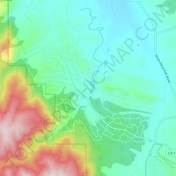
Name: Perry Park topographic map, elevation, terrain.
Location: Perry Park, Douglas County, Colorado, United States (39.23850 -105.02706 39.27999 -104.94478)
Average elevation: 2,077 m
Minimum elevation: 1,894 m
Maximum elevation: 2,592 m
Thank you for supporting this site ❤️
Make a donation
Make a donation
Other topographic maps
Click on a map to view its topography, its elevation and its terrain.
Thank you for supporting this site ❤️
Make a donation
Make a donation
Thank you for supporting this site ❤️
Make a donation
Make a donation