
Thank you for supporting this site ❤️
Make a donation
Make a donation
Ilesha West topographic map
Click on the map to display elevation.
Thank you for supporting this site ❤️
Make a donation
Make a donation
About this map
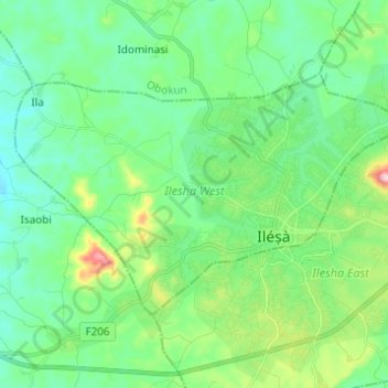
Name: Ilesha West topographic map, elevation, terrain.
Location: Ilesha West, Osun State, Nigeria (7.59984 4.65946 7.67579 4.78221)
Average elevation: 373 m
Minimum elevation: 304 m
Maximum elevation: 590 m
Thank you for supporting this site ❤️
Make a donation
Make a donation
Other topographic maps
Click on a map to view its topography, its elevation and its terrain.