
Lee County topographic map
Interactive map
Click on the map to display elevation.
About this map
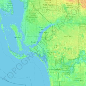
Name: Lee County topographic map, elevation, terrain.
Location: Lee County, Florida, USA (26.31613 -82.33504 26.78955 -81.56218)
Average elevation: 5 m
Minimum elevation: -2 m
Maximum elevation: 24 m
Other topographic maps
Click on a map to view its topography, its elevation and its terrain.