Ifo topographic map
Interactive map
Click on the map to display elevation.
About this map

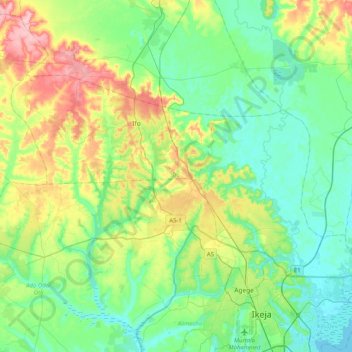
Name: Ifo topographic map, elevation, terrain.
Location: Ifo, Nigeria (6.63730 3.05040 6.86995 3.45766)
Average elevation: 41 m
Minimum elevation: -2 m
Maximum elevation: 141 m
Other topographic maps
Click on a map to view its topography, its elevation and its terrain.

Omu Aran
Nigeria > Kwara State > Irepodun
Omu Aran has a tropical wet and dry or savanna climate and is located at an elevation of 536.14 meters (1758.99 feet) above sea level (Classification: Aw). The district's average annual temperature is 0.26% higher than Nigeria's averages at 29.72°C (85.5°F). Omu Aran generally has 149.31 wet days per year…
Average elevation: 539 m