
Katzrin topographic map
Click on the map to display elevation.
About this map
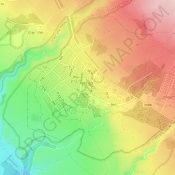
Name: Katzrin topographic map, elevation, terrain.
Location: Katzrin, Golan Subdistrict, North District, Israel (32.97474 35.67159 33.00748 35.71856)
Average elevation: 310 m
Minimum elevation: 170 m
Maximum elevation: 439 m
Other topographic maps
Click on a map to view its topography, its elevation and its terrain.
Majdal Shams
The name Majdal Shams is of Aramaic origin, meaning: "tower of sun," possibly in reference to the town's elevation. Another hypothesis suggests that the town was originally called Majdal al-Sham (Majdal of Damascus) to distinguish it from the towns of al-Majdal on the Mediterranean coast and al-Majdal on the…
Average elevation: 1,184 m