
Thank you for supporting this site ❤️
Make a donation
Make a donation
Mount Airy topographic map
Click on the map to display elevation.
Thank you for supporting this site ❤️
Make a donation
Make a donation
About this map
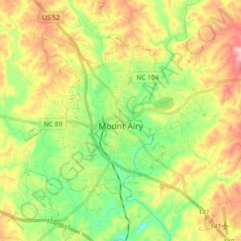
Name: Mount Airy topographic map, elevation, terrain.
Location: Mount Airy, Surry County, North Carolina, United States (36.45123 -80.65725 36.55165 -80.55811)
Average elevation: 346 m
Minimum elevation: 265 m
Maximum elevation: 452 m
Thank you for supporting this site ❤️
Make a donation
Make a donation
Other topographic maps
Click on a map to view its topography, its elevation and its terrain.