
Thank you for supporting this site ❤️
Make a donation
Make a donation
Bamyan Province topographic map
Click on the map to display elevation.
Thank you for supporting this site ❤️
Make a donation
Make a donation
About this map
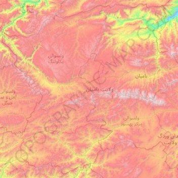
Name: Bamyan Province topographic map, elevation, terrain.
Location: Bamyan Province, Afghanistan (33.91186 66.27695 35.48097 68.26638)
Average elevation: 3,119 m
Minimum elevation: 1,439 m
Maximum elevation: 4,987 m
Thank you for supporting this site ❤️
Make a donation
Make a donation
Other topographic maps
Click on a map to view its topography, its elevation and its terrain.