
Thank you for supporting this site ❤️
Make a donation
Make a donation
Seymour topographic map
Click on the map to display elevation.
Thank you for supporting this site ❤️
Make a donation
Make a donation
About this map
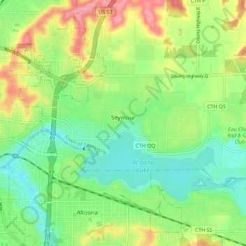
Name: Seymour topographic map, elevation, terrain.
Average elevation: 275 m
Minimum elevation: 235 m
Maximum elevation: 341 m
Thank you for supporting this site ❤️
Make a donation
Make a donation
Other topographic maps
Click on a map to view its topography, its elevation and its terrain.
Cleghorn
United States > Wisconsin > Eau Claire County > Town of Pleasant Valley
Average elevation: 307 m
Pinehurst Park
United States > Wisconsin > Eau Claire County > Eau Claire > Pinehurst
Average elevation: 289 m