
Thank you for supporting this site ❤️
Make a donation
Make a donation
Walley topographic map
Click on the map to display elevation.
Thank you for supporting this site ❤️
Make a donation
Make a donation
About this map
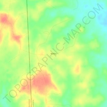
Name: Walley topographic map, elevation, terrain.
Location: Walley, Washington County, Alabama, United States (31.16462 -88.44502 31.20462 -88.40502)
Average elevation: 73 m
Minimum elevation: 45 m
Maximum elevation: 103 m
Thank you for supporting this site ❤️
Make a donation
Make a donation
Other topographic maps
Click on a map to view its topography, its elevation and its terrain.