
Thank you for supporting this site ❤️
Make a donation
Make a donation
Sauchrie topographic map
Click on the map to display elevation.
Thank you for supporting this site ❤️
Make a donation
Make a donation
About this map
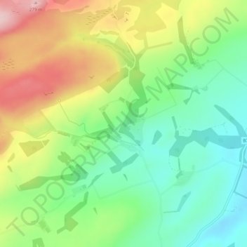
Name: Sauchrie topographic map, elevation, terrain.
Location: Sauchrie, South Ayrshire, Scotland, KA19 8EJ, United Kingdom (55.38647 -4.69354 55.40647 -4.67354)
Average elevation: 151 m
Minimum elevation: 64 m
Maximum elevation: 282 m
Thank you for supporting this site ❤️
Make a donation
Make a donation
Other topographic maps
Click on a map to view its topography, its elevation and its terrain.