
Thank you for supporting this site ❤️
Make a donation
Make a donation
Rush Springs topographic map
Click on the map to display elevation.
Thank you for supporting this site ❤️
Make a donation
Make a donation
About this map
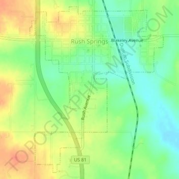
Name: Rush Springs topographic map, elevation, terrain.
Location: Rush Springs, Grady County, Oklahoma, 73082, United States (34.76277 -97.96794 34.78776 -97.94341)
Average elevation: 409 m
Minimum elevation: 387 m
Maximum elevation: 432 m
Thank you for supporting this site ❤️
Make a donation
Make a donation
Other topographic maps
Click on a map to view its topography, its elevation and its terrain.