
Thank you for supporting this site ❤️
Make a donation
Make a donation
Cox City topographic map
Click on the map to display elevation.
Thank you for supporting this site ❤️
Make a donation
Make a donation
About this map
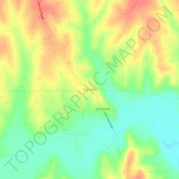
Name: Cox City topographic map, elevation, terrain.
Location: Cox City, Grady County, Oklahoma, United States (34.70535 -97.75170 34.74535 -97.71170)
Average elevation: 360 m
Minimum elevation: 329 m
Maximum elevation: 393 m
Thank you for supporting this site ❤️
Make a donation
Make a donation
Other topographic maps
Click on a map to view its topography, its elevation and its terrain.
Thank you for supporting this site ❤️
Make a donation
Make a donation
Thank you for supporting this site ❤️
Make a donation
Make a donation