
湛江市 topographic map
Interactive map
Click on the map to display elevation.
About this map
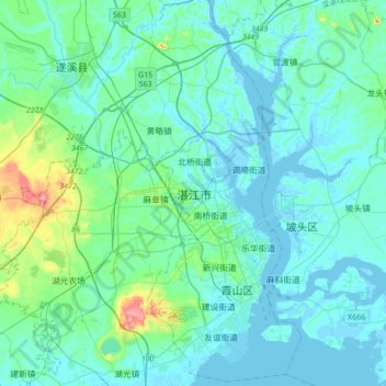
Name: 湛江市 topographic map, elevation, terrain.
Location: 湛江市, 赤坎区, 广东省, 524000, 中国 (21.11451 110.19413 21.43451 110.51413)
Average elevation: 21 m
Minimum elevation: -4 m
Maximum elevation: 164 m
Other topographic maps
Click on a map to view its topography, its elevation and its terrain.