
Izena topographic map
Interactive map
Click on the map to display elevation.
About this map
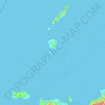
Name: Izena topographic map, elevation, terrain.
Location: Izena, Shimajiri, Okinawa Prefecture, Japan (26.79814 127.64823 26.99760 128.13152)
Average elevation: 3 m
Minimum elevation: 0 m
Maximum elevation: 335 m
The island's topography features a row of mountains spanning from the northwest to the southeast of the island, with generally flat, arable land covering the remainder. The island has several sandy beaches and designated camping areas with bathroom facilities. The view of Izena's rocky southern coastline is well known as one of Japan's best, with the rock formations 'Umi Gitara' and 'Agi Gitara' dramatically rising from the land and sea.
Other topographic maps
Click on a map to view its topography, its elevation and its terrain.