Geolocate

Lake Malombe topographic map

Interactive map

Click on the map to display elevation.

About this map

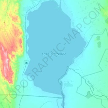
Name: Lake Malombe topographic map, elevation, terrain.

Location: Lake Malombe, Southern Region, Malawi (-14.80517 35.17552 -14.51998 35.34602)

Average elevation: 544 m

Minimum elevation: 471 m

Maximum elevation: 1,161 m

Other topographic maps

Click on a map to view its topography, its elevation and its terrain.

Limbe

Malawi > Blantyre > Limbe

Average elevation: 1,158 m

shire river

Malawi > Ntcheu

Average elevation: 976 m

Chirwa

Malawi > Kasungu > Chirwa

Average elevation: 1,167 m

Gandali

Malawi > Mchinji > Gandali

Average elevation: 1,098 m

Mikundi

Malawi > Dedza > Mikundi

Average elevation: 1,157 m

Mulanje

Malawi > Mulanje

Average elevation: 803 m

Lake Chilwa

Malawi > Zomba > Zomba

Average elevation: 647 m