
Thank you for supporting this site ❤️
Make a donation
Make a donation
Hogeye topographic map
Click on the map to display elevation.
Thank you for supporting this site ❤️
Make a donation
Make a donation
About this map
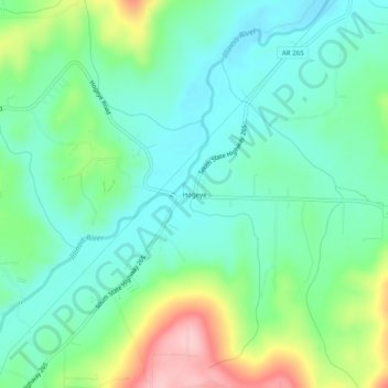
Name: Hogeye topographic map, elevation, terrain.
Location: Hogeye, Washington County, Arkansas, United States (35.90036 -94.28771 35.94036 -94.24771)
Average elevation: 414 m
Minimum elevation: 362 m
Maximum elevation: 541 m
Thank you for supporting this site ❤️
Make a donation
Make a donation
Other topographic maps
Click on a map to view its topography, its elevation and its terrain.