
Make a donation
Cagayancillo topographic map
Click on the map to display elevation.
Make a donation
Cagayancillo
There are neither mountain ranges nor forested areas in the municipality. A hilly portion in the north-eastern part of the main island has a slope of 3-82%. The other areas are flat with the highest elevation around 2 to 3 meters. The majority of the island has a sandy loam soil not enough to support a forest.
Make a donation
About this map
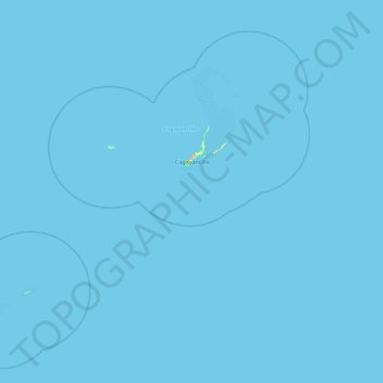
Name: Cagayancillo topographic map, elevation, terrain.
Location: Cagayancillo, Palawan, Mimaropa, 5321, Philippines (9.10244 120.61298 9.87678 121.47167)
Average elevation: 0 m
Minimum elevation: 0 m
Maximum elevation: 57 m
Make a donation
Other topographic maps
Click on a map to view its topography, its elevation and its terrain.
Make a donation
Make a donation
Make a donation
Make a donation
Make a donation
Make a donation
Make a donation
Make a donation
Make a donation
Make a donation
Make a donation
Make a donation
Make a donation
Make a donation
Make a donation
Make a donation
Make a donation
Make a donation
Make a donation
Make a donation
Likas Island
Philippines > Palawan > Kalayaan
West York Island, also known as Likas Island (Filipino: Pulo ng Likas, lit. 'Island of Naturality'; Mandarin Chinese: 西月島/西月岛; pinyin: Xīyuè Dǎo; Vietnamese: đảo Bến Lạc), and several other names. With an area of 18.6 hectares (46 acres), it is the third largest of the naturally…
Average elevation: 0 m
Make a donation
Make a donation
Make a donation
Make a donation
Make a donation