
Thank you for supporting this site ❤️
Make a donation
Make a donation
Pocasset topographic map
Click on the map to display elevation.
Thank you for supporting this site ❤️
Make a donation
Make a donation
About this map
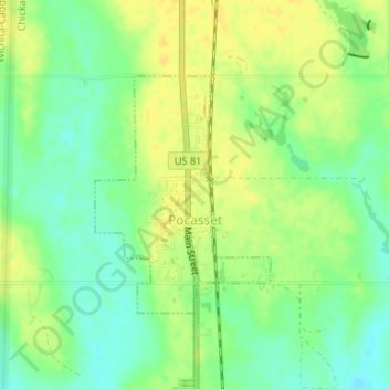
Name: Pocasset topographic map, elevation, terrain.
Location: Pocasset, Grady County, Oklahoma, United States (35.18720 -97.96106 35.20368 -97.94612)
Average elevation: 359 m
Minimum elevation: 346 m
Maximum elevation: 369 m
Thank you for supporting this site ❤️
Make a donation
Make a donation
Other topographic maps
Click on a map to view its topography, its elevation and its terrain.