
Thank you for supporting this site ❤️
Make a donation
Make a donation
Tallassee topographic map
Click on the map to display elevation.
Thank you for supporting this site ❤️
Make a donation
Make a donation
About this map
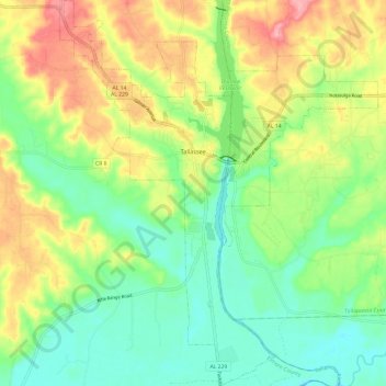
Name: Tallassee topographic map, elevation, terrain.
Location: Tallassee, Elmore County, Alabama, 36078, United States (32.45013 -85.94489 32.58732 -85.84104)
Average elevation: 99 m
Minimum elevation: 48 m
Maximum elevation: 177 m
Thank you for supporting this site ❤️
Make a donation
Make a donation
Other topographic maps
Click on a map to view its topography, its elevation and its terrain.
Thank you for supporting this site ❤️
Make a donation
Make a donation
Thank you for supporting this site ❤️
Make a donation
Make a donation