
Thank you for supporting this site ❤️
Make a donation
Make a donation
Governor's Island topographic map
Click on the map to display elevation.
Thank you for supporting this site ❤️
Make a donation
Make a donation
About this map
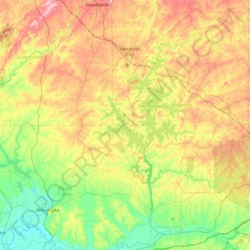
Name: Governor's Island topographic map, elevation, terrain.
Location: Governor's Island, Elmore County, Alabama, United States (32.43508 -86.28874 33.07508 -85.64874)
Average elevation: 164 m
Minimum elevation: 39 m
Maximum elevation: 377 m
Thank you for supporting this site ❤️
Make a donation
Make a donation
Other topographic maps
Click on a map to view its topography, its elevation and its terrain.
Thank you for supporting this site ❤️
Make a donation
Make a donation
Thank you for supporting this site ❤️
Make a donation
Make a donation