
Paços de Ferreira topographic map
Interactive map
Click on the map to display elevation.
About this map
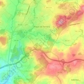
Name: Paços de Ferreira topographic map, elevation, terrain.
Location: Paços de Ferreira, Porto, Portugal (41.24757 -8.39599 41.28924 -8.36420)
Average elevation: 313 m
Minimum elevation: 225 m
Maximum elevation: 393 m
Other topographic maps
Click on a map to view its topography, its elevation and its terrain.
Modelos
Portugal > Porto > Paços de Ferreira
Modelos, Paços de Ferreira, Porto, 4590-551, Portugal
Average elevation: 296 m