
Thank you for supporting this site ❤️
Make a donation
Make a donation
Banks topographic map
Click on the map to display elevation.
Thank you for supporting this site ❤️
Make a donation
Make a donation
About this map
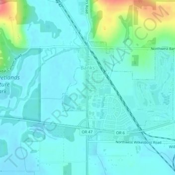
Name: Banks topographic map, elevation, terrain.
Location: Banks, Washington County, Oregon, 97106, United States (45.60876 -123.11985 45.62287 -123.09537)
Average elevation: 70 m
Minimum elevation: 52 m
Maximum elevation: 157 m
Thank you for supporting this site ❤️
Make a donation
Make a donation
Other topographic maps
Click on a map to view its topography, its elevation and its terrain.
Thank you for supporting this site ❤️
Make a donation
Make a donation
Vern Galaway Memorial Park
United States > Oregon > Washington County > North Plains
Average elevation: 56 m