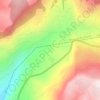
Ajlun topographic map
Click on the map to display elevation.
Ajlun
Ajloun is known for its high elevation, which makes it one of the coolest cities in Jordan, with an average maximum temperature during January of 8.2 degrees Celsius, and a minimum average temperature of 2.8 degrees Celsius. Snow is common during the winter.
About this map

Name: Ajlun topographic map, elevation, terrain.
Location: Ajlun, Jordan (32.18976 35.59209 32.43736 35.89212)
Average elevation: 442 m
Minimum elevation: -346 m
Maximum elevation: 1,246 m
Other topographic maps
Click on a map to view its topography, its elevation and its terrain.
Amman
Jordan > Amman > Amman Sub-District
Amman is situated on the East Bank Plateau, an upland characterized by three major wadis which run through it. Originally, the city had been built on seven hills. Amman's terrain is typified by its mountains. The most important areas in the city are named after the hills or mountains they lie on. The area's…
Average elevation: 800 m


B-08-15
Jordan > Mafraq > Badiah Shamaliyah Gharbiyah Sub-District > District 8
Average elevation: 658 m


Khirbat Dayr al Kinn
Jordan > Mafraq > Dair Al Kahf Sub-District > Deir El-Qenn
Average elevation: 1,149 m


Amman
Jordan > Amman > Amman Sub-District
Amman is situated on the East Bank Plateau, an upland characterized by three major wadis which run through it. Originally, the city had been built on seven hills. Amman's terrain is typified by its mountains. The most important areas in the city are named after the hills or mountains they lie on. The area's…
Average elevation: 800 m

Anjara
Jordan > Ajlun > Ajloun Sub-District
Situated at an elevation of 905 meters above sea level, Anjara is distinguished by its lush green landscapes and abundance of fruit-bearing trees. The town is surrounded by forests and woodland areas, and it is considered one of the most productive regions for olive cultivation.
Average elevation: 961 m


Wadi Rum desert
Jordan > Aqaba > Wadi Rum Village
The area is centered on the main valley of Wadi Rum. The highest elevation in Jordan is Jabal Umm ad Dami at 1,840 m (6,040 ft) high (SRTM data states 1854 m), located 30 kilometres south of Wadi Rum village. It was first located by Difallah Ateeg, a Zalabia Bedouin from Rum. On a clear day, it is possible to…
Average elevation: 1,041 m




Zarqa
Jordan > Zarqa > Zarqa Sub-District
Zarqa has a cold semi-arid climate (Köppen climate classification: BSk). The average annual temperature is 17.4 °C (63.3 °F), and around 182 mm (7.17 in) of precipitation falls annually, mostly in winter months. Zarqa's elevation is 619 meters above sea level, and the city occasionally receives snowfall in…
Average elevation: 617 m


Wadi Shuʿeib
Jordan > Balqa > Al-Salt Sub-District > Al Salt
Wadi Shueib lies west of Sweileh at elevations from 1,200 meters (3,900 ft) to sea level. It drains an area of approximately 180 square kilometers (69 sq mi).
Average elevation: 857 m




Zarqa
Jordan > Zarqa > Zarqa Sub-District
Zarqa has a cold semi-arid climate (Köppen climate classification: BSk). The average annual temperature is 17.4 °C (63.3 °F), and around 182 mm (7.17 in) of precipitation falls annually, mostly in winter months. Zarqa's elevation is 619 meters above sea level.
Average elevation: 617 m

Amman
Jordan > Amman > Amman Sub-District
Amman is situated on the East Bank Plateau, an upland characterized by three major wadis which run through it. Originally, the city had been built on seven hills. Amman's terrain is typified by its mountains. The most important areas in the city are named after the hills or mountains they lie on. The area's…
Average elevation: 800 m


Wadi Rum Protected Area
Jordan > Aqaba > Aqaba Sub-District
The area is centered on the main valley of Wadi Rum. The highest elevation in Jordan is Jabal Umm ad Dami at 1,840 m (6,040 ft) high (SRTM data states 1854 m), located 30 kilometers south of Wadi Rum village. It was first located by Difallah Ateeg, a Zalabia Bedouin from Rum. On a clear day, it is possible to…
Average elevation: 1,041 m

Iraq Al-Amir
Jordan > Amman > Wadi Essier Sub-District
'Iraq al-Amir or Araq el-Amir (Arabic:عراق الأمير - literally, "Caves of the Prince"), is the name shared by a town and nearby caves, within the municipality of Amman in the Jordan Valley. Located about 15 km southwest of the town of Wadi as-Seer, it has a population of about 6000 people, mostly…
Average elevation: 487 m










Wadi Rum Protected Area
Jordan > Aqaba > Aqaba Sub-District
The area is centered on the main valley of Wadi Rum. The highest elevation in Jordan is Jabal Umm ad Dami at 1,840 m (6,040 ft) high (SRTM data states 1854 m), located 30 kilometers south of Wadi Rum village. It was first located by Difallah Ateeg, a Zalabia Bedouin from Rum. On a clear day, it is possible to…
Average elevation: 1,041 m