
Thank you for supporting this site ❤️
Make a donation
Make a donation
Chontamarca topographic map
Click on the map to display elevation.
Thank you for supporting this site ❤️
Make a donation
Make a donation
About this map
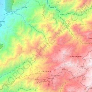
Name: Chontamarca topographic map, elevation, terrain.
Location: Chontamarca, Cañar, Ecuador (-2.46312 -79.26147 -2.30198 -79.04473)
Average elevation: 1,734 m
Minimum elevation: 159 m
Maximum elevation: 3,393 m
Thank you for supporting this site ❤️
Make a donation
Make a donation
Other topographic maps
Click on a map to view its topography, its elevation and its terrain.