
Thank you for supporting this site ❤️
Make a donation
Make a donation
Daryanah topographic map
Click on the map to display elevation.
Thank you for supporting this site ❤️
Make a donation
Make a donation
About this map
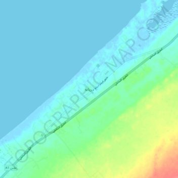
Name: Daryanah topographic map, elevation, terrain.
Location: Daryanah, Benghazi, Libya (32.30800 20.27111 32.38800 20.35111)
Average elevation: 11 m
Minimum elevation: -4 m
Maximum elevation: 55 m
Thank you for supporting this site ❤️
Make a donation
Make a donation
Other topographic maps
Click on a map to view its topography, its elevation and its terrain.