
Thank you for supporting this site ❤️
Make a donation
Make a donation
Linwood topographic map
Click on the map to display elevation.
Thank you for supporting this site ❤️
Make a donation
Make a donation
About this map
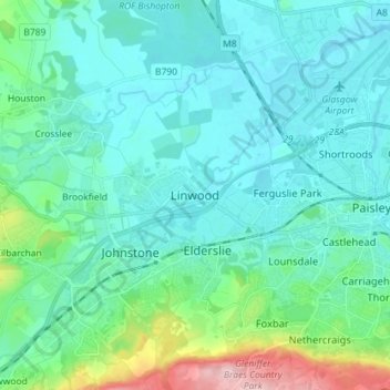
Name: Linwood topographic map, elevation, terrain.
Location: Linwood, Renfrewshire, Scotland, PA3 3DG, United Kingdom (55.80814 -4.52865 55.88814 -4.44865)
Average elevation: 37 m
Minimum elevation: -2 m
Maximum elevation: 217 m
Thank you for supporting this site ❤️
Make a donation
Make a donation
Other topographic maps
Click on a map to view its topography, its elevation and its terrain.