
Abeokuta topographic map
Click on the map to display elevation.
About this map
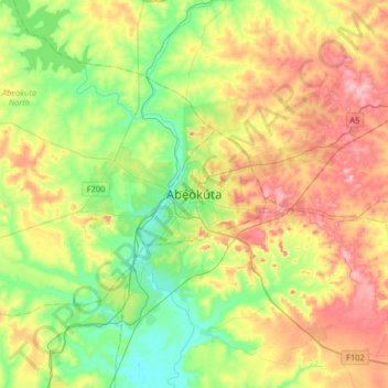
Name: Abeokuta topographic map, elevation, terrain.
Location: Abeokuta, Abeokuta South, Ogun State, 111101, Nigeria (6.99471 3.18673 7.31471 3.50673)
Average elevation: 95 m
Minimum elevation: 12 m
Maximum elevation: 219 m
Other topographic maps
Click on a map to view its topography, its elevation and its terrain.