
Make a donation
Clifton topographic map
Click on the map to display elevation.
Make a donation
About this map
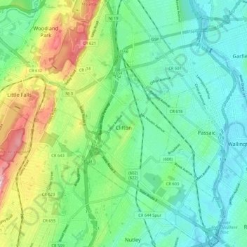
Name: Clifton topographic map, elevation, terrain.
Location: Clifton, Passaic County, New Jersey, United States (40.81993 -74.19773 40.89940 -74.11780)
Average elevation: 56 m
Minimum elevation: 1 m
Maximum elevation: 187 m
Make a donation
Other topographic maps
Click on a map to view its topography, its elevation and its terrain.
Bearfort Mountain
United States > New Jersey > Passaic County > West Milford
At an elevation of 1,331 feet (406 m) the ridge is the site of a 68 feet (21 m) high fire lookout tower built by the New Jersey Forest Fire Service.
Average elevation: 354 m
Make a donation
Cupsaw Lake
United States > New Jersey > Passaic County > Ringwood > Erskine Lakes
Average elevation: 157 m
Make a donation
Upper Greenwood Lake
United States > New Jersey > Passaic County > West Milford
Average elevation: 360 m
Make a donation
Township of Wayne McCoog Park
United States > New Jersey > Passaic County > Wayne
Average elevation: 55 m
Make a donation