
Fundy National Park of Canada topographic map
Interactive map
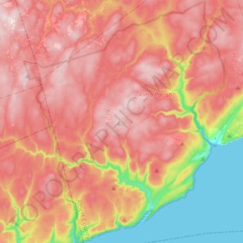
Click on the map to display elevation.
About this map
Name: Fundy National Park of Canada topographic map, elevation, terrain.
Average elevation: 230 m
Minimum elevation: -3 m
Maximum elevation: 396 m
Other topographic maps
Click on a map to view its topography, its elevation and its terrain.
Storeytown
Canada > New Brunswick > Blissfield Parish > Doaktown
Storeytown, Doaktown, Blissfield Parish, Northumberland County, New Brunswick, E9C 1G7, Canada
Average elevation: 83 m
Moncton
Canada > New Brunswick > Moncton
Moncton, Moncton Parish, Westmorland County, New Brunswick, Canada
Average elevation: 52 m
Clarendon Parish
Clarendon Parish, Charlotte County, New Brunswick, Canada
Average elevation: 160 m