
Make a donation
Kendall West topographic map
Click on the map to display elevation.
Make a donation
About this map
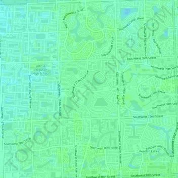
Name: Kendall West topographic map, elevation, terrain.
Location: Kendall West, Miami-Dade County, Florida, United States (25.68453 -80.44761 25.72849 -80.42985)
Average elevation: 6 m
Minimum elevation: 1 m
Maximum elevation: 8 m
Make a donation
Other topographic maps
Click on a map to view its topography, its elevation and its terrain.
Make a donation
Make a donation
Make a donation
Make a donation
Florida City
United States > Florida > Miami-Dade County
Florida City is situated mostly atop a limestone ridge called the Miami Rock Ridge that extends south from present day North Miami Beach to a location in Everglades National Park. The ridge, consisting of Miami limestone, serves as the higher ground within the community. The ridge extended from northeast to…
Average elevation: 3 m
Pops Hammock Seminole Village
United States > Florida > Miami-Dade County > Pops Hammock Seminole Village
Average elevation: 3 m
Make a donation
Miami
United States > Florida > Miami-Dade County
Miami and its suburbs are located on a broad plain between the Everglades to the west and Biscayne Bay to the east, which extends from Lake Okeechobee southward to Florida Bay. The elevation of the area averages at around 6 ft (1.8 m) above sea level in most neighborhoods, especially near the coast. The…
Average elevation: 4 m
Make a donation
Make a donation
Make a donation
Make a donation
Make a donation
Make a donation
Sun-Tan Village
United States > Florida > Miami-Dade County > Hialeah > Sun-Tan Village
Average elevation: 7 m
Make a donation
Hawley Heights
United States > Florida > Miami-Dade County > Kendall > Hawley Heights
Average elevation: 7 m
Miami Heights Trailer Park
United States > Florida > Miami-Dade County > Miami Heights Trailer Park
Average elevation: 7 m
Make a donation
Make a donation