
Kuje topographic map
Click on the map to display elevation.
About this map
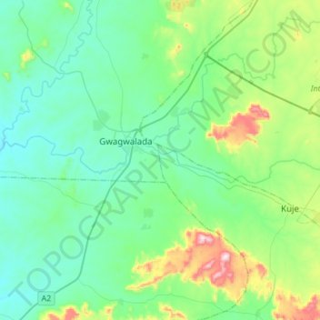
Name: Kuje topographic map, elevation, terrain.
Location: Kuje, Federal Capital Territory, Nigeria, Usuma (8.90014 6.98120 8.94016 7.25618)
Average elevation: 252 m
Minimum elevation: 137 m
Maximum elevation: 689 m
Other topographic maps
Click on a map to view its topography, its elevation and its terrain.