
瑶村 topographic map
Interactive map
Click on the map to display elevation.
About this map
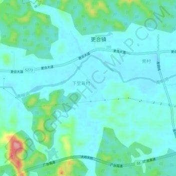
Name: 瑶村 topographic map, elevation, terrain.
Location: 瑶村, 佛山市, 广东省, 中国 (22.77865 112.51871 22.81865 112.55871)
Average elevation: 40 m
Minimum elevation: 15 m
Maximum elevation: 155 m
Other topographic maps
Click on a map to view its topography, its elevation and its terrain.