
Wasatch Range topographic map
Interactive map
Click on the map to display elevation.
About this map
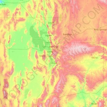
Name: Wasatch Range topographic map, elevation, terrain.
Location: Wasatch Range, Salt Lake County, Utah, USA (38.36966 -111.92048 42.68042 -111.08277)
Average elevation: 1,880 m
Minimum elevation: 1,109 m
Maximum elevation: 4,021 m
Other topographic maps
Click on a map to view its topography, its elevation and its terrain.